
Waxahachie Previous Resident Sources
The most dependable backward trail uses sources by era and role. A deed traces a legal transfer. A directory or census can place a household at an address. A map can test whether the building or block existed in the same form. For previous residents of a Waxahachie address, begin with the parcel and use the table as a record-by-record sequence, not as proof that every source identifies the same kind of person.
| Source | Years it covers | Where held | What it shows |
|---|---|---|---|
| County Clerk and TexasFile deed index | Displayed online 1841-present | County Clerk, TexasFile, counter and books | Transfers, grantor, grantee, date, instrument, and legal description |
| TexasFile plat-map lead | Displayed 1957-present | TexasFile and County Clerk | Lot, block, subdivision, and legal-continuity clues |
| Local directories and street sections | 1895-96, 1907, 1922, 1927-28, 1942; 1948 catalog; 1969 and 1976 leads | Sims, survey, TSLAC, and family-history catalogs | Listed household, street, business, and printed notations when present |
| Federal census | 1850-1950 public schedules | Census, NARA, HeritageQuest, and Ancestry Library Edition | Household composition on the census date |
| Sanborn maps | 1885, 1890, 1893, 1898, 1904, 1909, 1914 | LOC, UT, Portal, and Sims links | Building, block, use, and numbering context |
| Permits, cemetery, newspapers, probate | Collection-specific dates | City, Sims, County Clerk, and local sources | Project, death, heir, or family chronology leads |
For a recent transfer, begin with the deed and appraisal record. For a household question in an older era, use a located directory and the closest census. If the address itself is uncertain, return to the legal description and the historic map before carrying a name forward.
Waxahachie Parcel Before Names
Start an address history at the Ellis Central Appraisal District public portal, where the documented search choices include account number, address, and owner name. Record the property ID and legal description with the current owner, situs address, and mailing address. The situs is the physical parcel. A mailing address is where a tax notice goes and can be a post-office box, business, or another city, so it does not prove where an owner lived.
Next, use the city or county GIS layer to compare the parcel with city limits, ZIP boundaries, annexations, and the surrounding roads. Waxahachie Planning GIS handles addresses inside city limits; Ellis County GIS handles those outside. The legal description is the bridge to the deed index because an old street number can be absent, changed, or shared by a later parcel configuration.
Ellis County Deed Chain
A deed chain moves backward through legal transfers, not directly through former occupants. Find the current owner as the grantee in the purchase deed. The seller in that deed is the grantor. Then search that seller as a grantee to locate the earlier purchase, and repeat while comparing the legal description at each step. A split, combination, replat, or metes-and-bounds change can break an apparent match even when the present street address looks the same.
- Save the current ECAD property ID, situs, and complete legal description.
- Use the Ellis County TexasFile index to find the current grantee’s purchase or search by instrument or volume and page.
- Record the grantor, grantee, recording date, document type, instrument number or BVP/No., and legal description.
- Search the seller, now the grantor, as a grantee for the earlier acquisition and compare the tract language.
- Continue one transfer at a time. Use the County Clerk counter, historic books, or records help when an image, older book, or certification is not available online.
- Grantor
- The person or entity transferring an interest in a recorded document.
- Grantee
- The person or entity receiving that interest. In a purchase deed, the grantee is normally the buyer.
- Chain of title
- The connected sequence of recorded transfers for the same tract, checked by legal description rather than a name alone.
- Legal description
- The lot, block, subdivision, or metes-and-bounds language that identifies land for recording purposes.
Waxahachie Index and Plat Dates
The reported coverage is unusually long, but it needs careful reading. TexasFile displays an Ellis County full index beginning August 12, 1841 and a plat-map series beginning April 30, 1957. Those dates describe the reported index coverage, not a guarantee that every earlier instrument survives, every field is searchable, or every image is available without cost. The inspection page was current through August 2026, so a researcher should still confirm the live display before relying on a cutoff.
The index offers name, instrument-number, and volume/page search. Its result fields include County, Date, Type, Grantor, Grantee, BVP/No., and Legal Desc. Search and some registration are free, while image previews or high-quality PDF copies may require an account or purchase. The County Clerk remains the route for counter help, older books, certification, and material not exposed by the index. County preservation work follows Texas State Library and Archives Commission guidance for restoration, reproduction, and preservation of fragile records.
Waxahachie Address Continuity
Do not assume a modern address can be read backward without a map check. The circa-1850 Waxahachie town plat shows streets, lots, blocks, churches, and the public square. A 1974 comprehensive-plan description says the early grid had blocks generally about 200 feet square, while rail lines and Waxahachie Creek created discontinuities and dead ends. Compare the historic block with the parcel description and then with the directory street section.
No authoritative source located a citywide 1912 renumbering or renaming event. The reliable route is the legal description, historic plat, directory street listing, and city GIS annexation or disannexation layer. That protects the prior-residents trail from treating an unverified address change as a fact.
Waxahachie’s city map service supplies parcel, ZIP Code, city-limit, annexation and disannexation, zoning, floodplain, district, and historic-resource layers. Ellis County GIS adds the broader county road, address, and NCT911 context. When a Waxahachie mailing address falls near an edge, check those layers before attaching an older county reference to a present city parcel.
Waxahachie Past Household Trails
Past residents are not always past owners. The 1927-28 Coward volume is documented as including a street directory and householder/property-owner guide, but the research did not expose a personal page or its marks. Use the exact local volume to identify the address-to-household route, then pair it with the nearest public census. The separate historical editions and their access paths are covered on the Waxahachie City Directory page.
- Choose the located directory year closest to the target period and record the page, spelling, address, and any printed household notation.
- Check the adjacent located edition, not an assumed annual issue, for a move, name variant, or changed address.
- Pair the result with the nearest 1850-1950 public federal census, noting that the census fixes a household on one date.
- Use a Sanborn sheet to test the block or building context between directory years and deed transfers.
- Label owner, occupant, tax-mail recipient, permit applicant, and census household member as separate roles.
A directory suggests who was listed at an address. A census shows a household at its enumeration date. A deed shows a transfer of an interest. Keeping those roles apart is the core quality check when asking who lived here before.
Lawful house-history research. Use Waxahachie past-resident records for family and property history, and never use a finding to stalk, harass, or harm a living person.
Waxahachie House History Help
Sims Library’s Reference and Genealogy service publishes “Find the History of Your House,” a guide to historic-house research, and offers one-on-one genealogy help. Bring a present address, legal description, known owner names, and target era. The service points to local books, microfilm, archives, and databases, but does not promise a staff-produced title search. A reference appointment is the way to ask about a particular directory or microfilm lead.
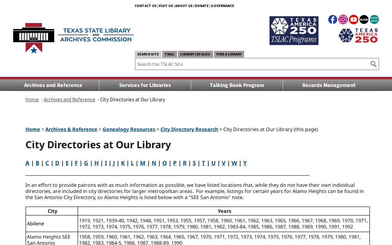
The Texas State Library and Archives Commission city-directory list supplies catalog leads for Waxahachie, including 1922, 1969, and 1976.
Sims makes Ancestry Library Edition available in the library, while HeritageQuest and HeritageHub have different genealogy and remote or card-access paths. That comparison helps a researcher plan the access channel before traveling or paying for an image.
Waxahachie Previous Resident Endpoints
When the household trail ends, probate, obituaries, and cemetery material can establish a later event or point toward heirs. The Ellis County Clerk holds probate records, where filings may contain names, addresses, notices, estate property, or executor information. City cemetery records reach to the mid-1800s, and Sims connects the Daily Light microfilm, HeritageHub, NewsBank, and the Portal to Texas History. None of these items alone proves a move date or current location.
Sanborn maps are especially helpful between deed and directory years. The Library of Congress holds a July 1890 Waxahachie set of four sheets, and local references identify additional years through 1914. A map can date building use or block conditions, while a permit or newspaper notice can add a construction or conversion lead. Preserve the source identifier, such as a deed number, directory page, map sheet, or probate cause, with every conclusion.
Note: If an online search stops, use the Clerk counter, Sims microfilm and reference help, archives, or a written records request rather than filling a gap with an assumption.