
Waxahachie Neighbors by Parcel
A block search has several layers, and each has a different purpose. The public map defines the parcels that are actually adjacent. ECAD can then supply owner and property fields for each chosen parcel. Deeds and plats add the legal description and recorded transfer trail. Voter and association material has narrower access and privacy boundaries. A Waxahachie neighbors search should label every result as a parcel, owner, voter-record, or community-document fact rather than merging them into one claim about a household.
| Source | What It Shows About a Block | Access |
|---|---|---|
| City ArcGIS parcels and addresses | Adjacent geometry, street labels, ZIP, city-limit, district, historic, flood, and code context | Public map service; a neighbor-radius tool was not documented |
| Ellis County GIS | County parcel and address context, road names, NCT911, and district layers | Public portal; county authority outside city limits |
| ECAD | Owner, parcel identifiers, situs, mailing address, values, and legal-description lead | Public portal; card fields vary |
| County deed and plat records | Lot, block, subdivision, recorded transfers, and association agreements | Index, counter, and record-image channels |
| Voter file | Registered-voter status, precinct, and related statutory fields where released | Request route; protected information omitted |
| HOA management certificates | Association, city, ZIP, and management-certificate PDF | State registry; no member list |
Owners are not necessarily occupants. An ECAD tax mailing address can be outside the parcel, and a recorded deed reflects a transfer rather than a move. Keep that distinction when comparing your Waxahachie neighbors.
Map a Waxahachie Neighbor Block
The documented method is a parcel walk. In the city ArcGIS service, turn on Parcels and Address, locate the target, select its geometry, and inspect the polygons that touch it and the roads that divide it. A dedicated buffer, radius, rectangle-selection, or neighboring-parcel export control was not documented in the reviewed source. Do not assume the live viewer has one. The defensible result is the set of manually identified adjoining parcels, each checked separately.
- Locate the target address in the city map when it is inside Waxahachie limits. Use the Ellis County GIS portal for county context or an address outside city limits.
- Turn on parcel and address layers, then record the parcel or map identifier for each polygon that shares an edge with the target parcel.
- Open each selected parcel in ECAD. Compare owner name, situs, tax-mailing address, property or account ID, and legal description without treating a mailing address as occupancy.
- Use the legal description in the County Clerk index when a plat, subdivision agreement, or transfer needs to be checked.
Waxahachie’s ArcGIS MapServer lists the city layers used to put that parcel walk in context.
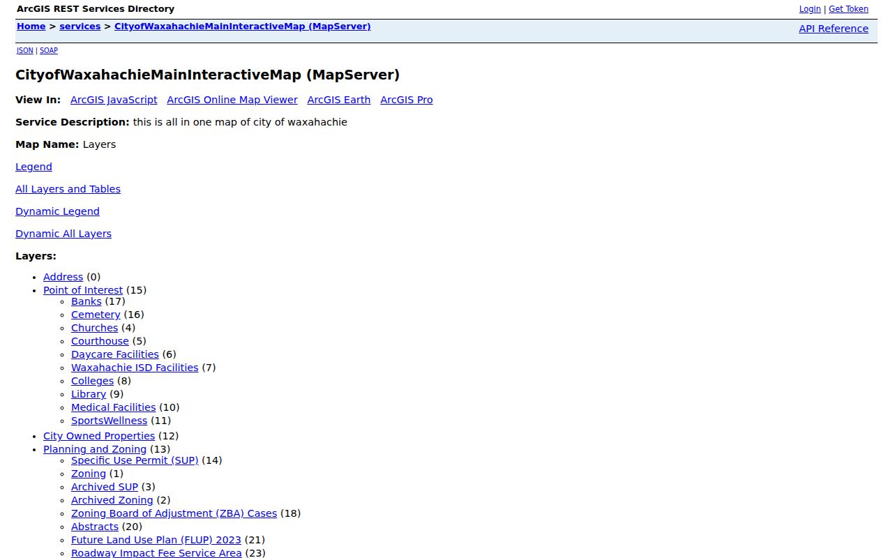
The service exposes Parcels, City Limit, ZIP Codes, annexations and disannexations, zoning, floodplain, districts, and historic-resource layers. It supplies block context, but it does not identify every person living nearby.
For a whole named street rather than its adjoining parcels, use the Waxahachie streets search to follow the broader address-record trail.
Waxahachie Neighbor Parcel Layers
Layer choices help explain why adjacent lots may have different city or county records. The city map offers address, planning and zoning, roads, elevation, Floodplain 2023, historic-resource survey, National Register, special districts, parcels, and boundary layers. Its City Limit, ZIP Codes, Annexations and Disannexations, police, school, code-enforcement, and flood layers can show a jurisdictional distinction without guessing from a postal label.
Waxahachie Planning GIS assigns and validates addresses inside city limits. Ellis County GIS handles the address question outside those limits and provides web maps, address lists, existing road names, and an NCT911 Address Map. Check the map boundary before assuming a nearby parcel is served by the same office. The city’s Locate page links its Neighborhood Services Map and other local place resources.
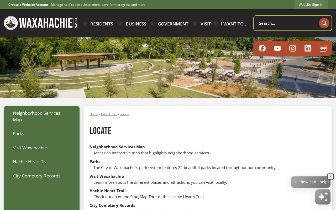
That city resource is useful for neighborhood-service context. It does not publish a citywide roster or identify member households.
ECAD and Waxahachie Neighbors
ECAD’s public portal exposes routes for account number, address, owner name, property ID, owner ID, geographic ID, reference ID, tax office ID, property address, and property type. When a parcel has been chosen on the map, preserve its property ID and legal description first. Those identifiers are more stable than a street label if a parcel is replatted, combined, or split. The client-rendered card was not available for complete field inspection, so do not assume every record displays the same details.
Read the two addresses separately. The situs is the physical parcel. The mailing address is where the appraisal or tax notice goes and may belong to a post office box, a business, or another city. A homestead exemption can be consistent with owner occupancy, but it cannot identify every resident. Follow a transfer by searching grantor, grantee, instrument, date, type, instrument or book-page number, and legal description in the Ellis County deed index.
Note: Record the parcel ID before comparing names, because the same street can have adjoining tracts with different legal descriptions and owners.
Waxahachie Voter Block Records
An individual VoteTexas lookup is not an address-by-address block roster. The documented broader local route is the Ellis County Elections public-information form, which lists a voter file with voting history for an individual or the full county at $5. The state request form also has active and suspense selections, an effective-date range, delivery choices, and file-layout materials. Request the existing record from the custodian, then read only the fields lawfully released.
Voting history tells which elections a person participated in, not ballot choices. Texas law treats application phone information, Social Security numbers, driver-license numbers, and DPS personal-identification numbers as confidential. Protected voters can have a residence withheld or replaced with asterisks. A limited individual search does not mean a lawful full-file request is unavailable, but neither route can promise every household or every nearby address.
Waxahachie HOA Record Limits
Recorded subdivision documents can show that an association agreement exists. Waxahachie’s subdivision ordinance describes an association agreement for subdivisions with common space or private facilities, including mandatory lot-owner membership and shared expense provisions when such an agreement is established in recorded land documents. Those recorded terms identify the property framework. They are not a resident directory.
The Texas HOA management-certificate registry is the strongest association inventory located for this area. Its filters include association type, HOA name, county, city, and ZIP. A result can lead to a management certificate PDF with association or management information. It does not publish member names or household rosters. Use County Clerk land records for the related plat or agreement when a specific parcel must be placed inside a recorded subdivision.
Waxahachie Neighbor Associations
The state certificate search identifies several Waxahachie associations. These records are useful for a subdivision or management-document lead, not for identifying residents. A city or ZIP label can be a mailing label rather than proof that each associated parcel falls inside the city limit. Verify the parcel against GIS and the recorded plat before drawing a boundary.
| Association record located | City and ZIP shown | What the certificate provides |
|---|---|---|
| Billingsley Farms HOA, Garden Valley Meadows HOA, Buffalo Ridge HOA | Waxahachie 75165 | State management-certificate lead, not a member directory |
| Estates of Garden Valley HOA, Springside Estates HOA, Waxahachie 147 HOA | Waxahachie 75165 | State management-certificate lead, not a member directory |
| Springfield Lakes HOA and Oaks of North Grove | Waxahachie 75165 | State management-certificate lead, not a member directory |
| Aday Estates Homeowners Association and Maypearl Hidden Hills Owners Association | Waxahachie 75167 | State management-certificate lead, not a member directory |
Texas HOA management-certificate search results for Waxahachie are the source for this association layer.
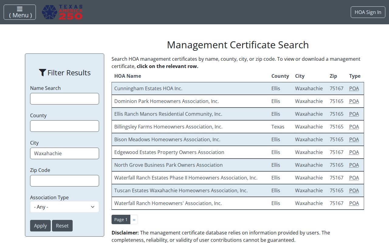
Read each certificate for the association and management information it actually contains. Do not infer current residents or a private membership list from the certificate.
Waxahachie Neighbor History Clues
Historical affiliation can illuminate an older block without becoming a current roster. Sims Library and the Portal to Texas History point to DAR Ellis County volumes with church, cemetery, family, school, pioneer, military, will, and marriage material. The local index identifies First Methodist, Central Presbyterian, St. Paul Episcopal, First Baptist, Main Street Christian, First Presbyterian, St. Joseph Catholic, Masonic, Eastern Star, and Odd Fellows material among its historical leads.
Those sources can help explain a surname variant, an obituary reference, or a former resident’s organization. They do not establish present affiliation. No official local source in the research published current church, fraternal, school, civic-club, block-watch, or private-association rosters. Sims Library’s microfilm, genealogy help, Daily Light material, cemetery clues, and the Ellis County Museum are better routes for a dated historical question.
Waxahachie Neighbor Boundaries
Postal labels and municipal boundaries can diverge around a Waxahachie block. The city’s postal set includes standard delivery ZIPs 75165 and 75167, plus 75168, which is a post-office-box ZIP rather than a conventional physical-residence area. A nearby address can carry a Waxahachie postal name while being near or beyond a city boundary. Check the exact address with USPS, then compare the city-limit, ZIP, and annexation layers with ECAD’s situs and the deed legal description.
This geography matters because the city handles address assignment inside city limits while Ellis County GIS is the fallback outside them. The city’s annexation and disannexation layers can explain why adjacent parcels appear under different municipal context. The original 200-foot street grid was not fully continuous because railroads and Waxahachie Creek created dead ends and breaks, so street text alone is not a reliable substitute for parcel geometry.
Official Records and Neighbor Tools
Official sources and commercial neighbor tools serve different purposes. An official parcel, deed, or voter record identifies a dated field held by a custodian and often supplies a request or correction path. A commercial category may combine records and other information into a profile, but its matching, timing, and removal practices can vary. For a disputed match, use the custodian’s original record rather than treating a compiled profile as proof.
| Official parcel records | Commercial neighbor category |
|---|---|
| ECAD, GIS, deed, and plat sources identify parcel-specific fields and legal transfers. | May combine data from different sources into a profile with varying freshness and matching quality. |
| Each record has a named custodian, date, access channel, and correction route. | Correction or removal follows that service’s own privacy channel and may require a separate request. |
| Public access still excludes protected addresses and private household information. | A profile should not replace the original custodian’s record or expand access to protected information. |
Privacy for Waxahachie Neighbors
Property records do not reveal every member of a household. Private association lists, utility customer records, delivery data, motor-vehicle address history, protected voter addresses, sealed or juvenile records, and nonpublic victim information remain outside this block method. A protected voter can appear with an obscured address, and Texas address-confidentiality programs can keep an actual residence out of the regular voter-registration system.
Keep a block result narrow: parcel, source, role, and date. If a government record needs correction, contact the actual custodian, such as ECAD, Ellis County Elections, or the clerk. A request under the Texas Public Information Act should seek a specific existing non-exempt record, not a new list of residents. This protects accuracy as well as privacy.
Lawful use. Use Waxahachie neighbor records for personal, family-history, property, or civic research. Never use a block search to watch, stalk, harass, intimidate, or harm another person.